Bicycling in Queens
If you like to bike in order to explore, rather than just to exercise and put on miles, there’s nothing like NYC with its hundreds of destinations. This is particularly true with Queens, as it’s the largest of the five boroughs (Manhattan, Brooklyn, Bronx and Staten Island are the others) and has an unrivaled ethnic diversity.
Queens’ claim to fame is that almost half the population is born outside the U.S., the largest of any borough (next is Brooklyn which is a little over a third, which is also the average for all of NYC). It has the biggest Asian population east of the West Coast, so there are many opportunities to eat in Chinese, Korean, Indian and Japanese restaurants. It also has a large Latin population, about 20% of the residents, with most coming from Colombia, Puerto Rico, Ecuador, Mexico and the Dominican Republic. Many famous African Americans, who make up about 20% of the population, grew up or lived in Queens, especially musicians such as Run DMC, 50 Cent, Salt-N-Pepa, Chuck D, LL Cool J, Count Basie, Lena Horne, Ella Fitzgerald, John Coltrane and James Brown.
It’s by far the biggest borough at 108 sq mi. / 281 kms. It’s the second largest borough in population, around 2.3 million, second to Brooklyn at about 2.6 million. Queens is the middle of the boroughs for household income (way less than Manhattan and a little bit less than Staten Island) and the fourth least densely populated (behind Staten Island). Many neighborhoods in the borough are quiet and residential, almost suburban. The borders of the borough are in the map below.
Strategy of Biking in Queens
Whenever possible, be sure to use bike lanes, especially on busy streets. Queens Blvd was known as the “Boulevard of Death”. From 1990 to 2017, 186 people were killed on this street, including 138 pedestrians. In the last five years, there have been substantial improvements, including many stretches of bike lanes, but not yet a continuous one.
In Queens, there’s a grid system where numbered avenues run west to east, while numbered streets run north to south (opposite of Manhattan’s). Queens is often confusing because any numbered street can be called one, some or all of the following: Street, Avenue, Road, Boulevard, Terrace and Drive.
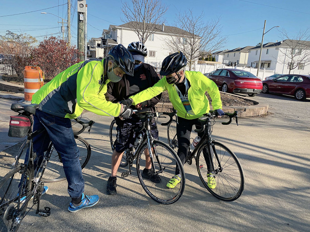
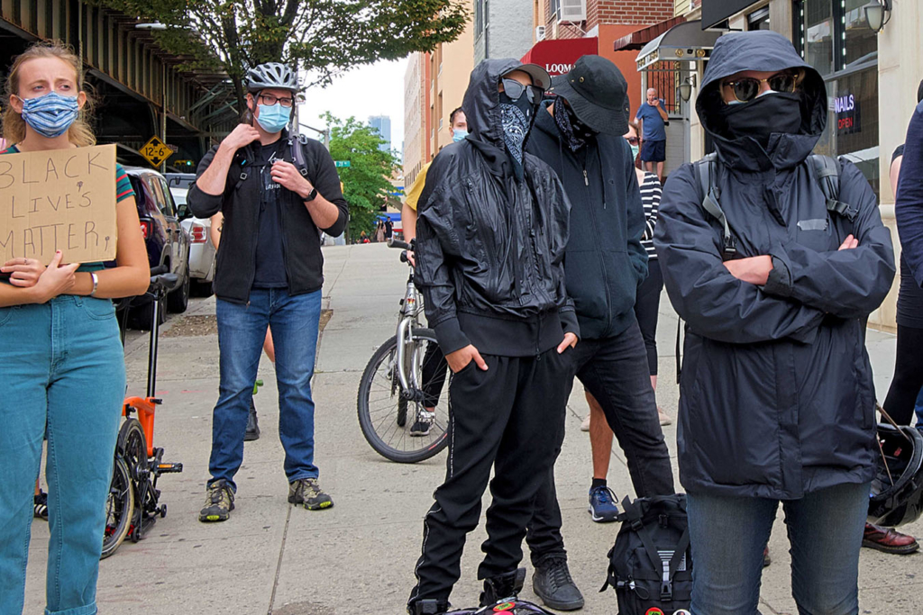
While it’s very unlikely for a biker to be mugged in any of the boroughs, there’s always a chance of it in a big city where you go through areas you are unfamiliar with, especially if you are riding on an expensive bike and have a pricey camera. To minimize the low probability of this happening, I highly recommend biking with a friend or two and only during the day. Also friends can help you if you have an accident or your bike breaks down.
Here are my frequent biking partners, Joe, Nick and Martin, as they were figuring out how to go to our next location from Idlewild Park, near JFK airport.
When biking, be sure to engage with the local people who are from diverse backgrounds. Most of the time, they will be happy to tell you about the neighborhood and their story.
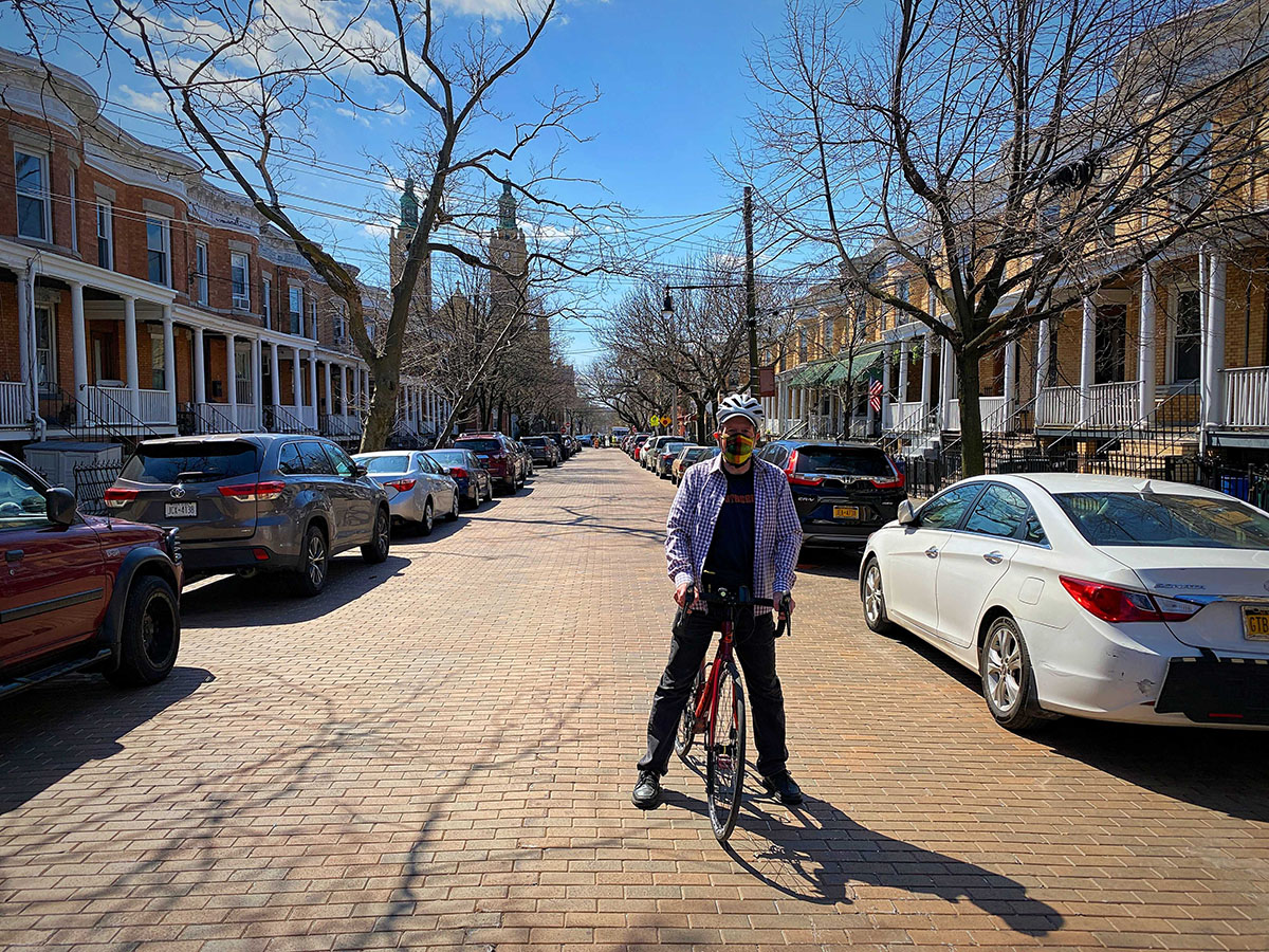
Biking is good exercise during the Covid-19 pandemic, as you are in the open air and almost always not close to anyone for even a few minutes. However, as long as this pandemic lasts, be sure to wear a mask and practice social distancing when you are off the bicycle.
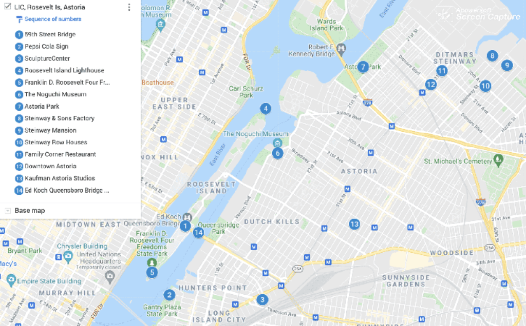
Long Island City & Astoria Biking Itinerary
This is a great introductory ride to Queens. It’s just over the 59th Street Bridge (Ed Koch Queensborough Bridge) and has great views of Manhattan. This ride is about 20 miles and two hours without stopping.
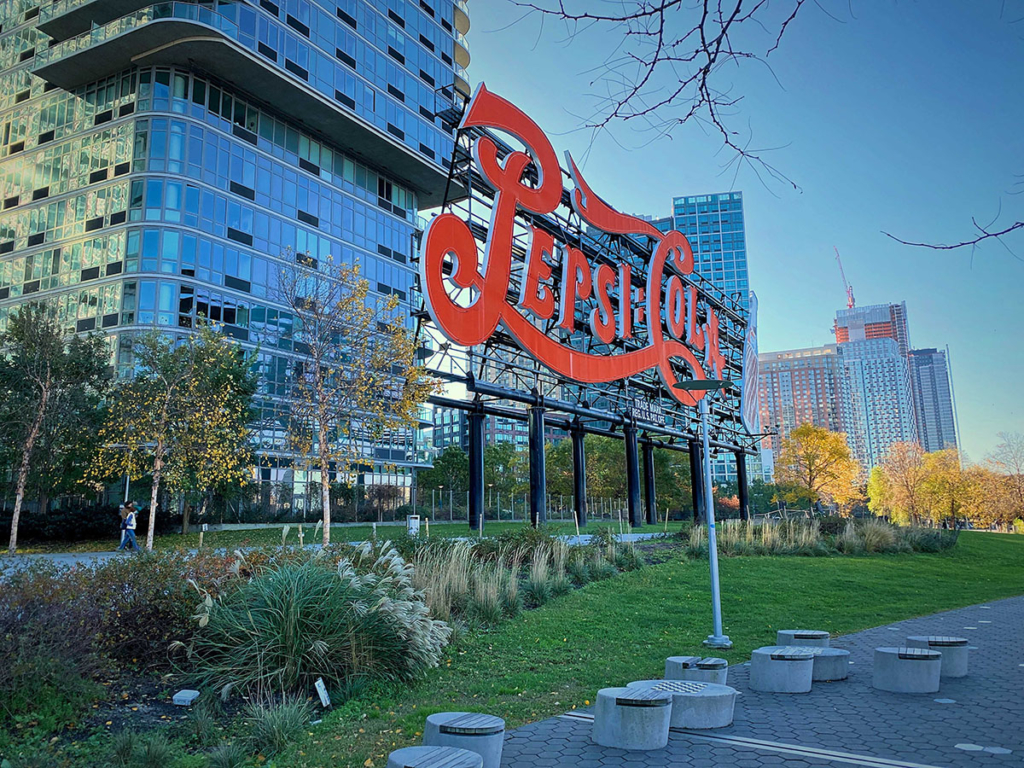
Pepsi Cola Sign
After entering Queens on the 59th Street Bridge, go south on Vernon Blvd and turn right on 46th Avenue. Soon you enter a park on the East River. In the middle of a number of blueish glass apartment buildings, there’s the famous Pepsi Cola Sign. The original sign was built in the 1940s on top of a Pepsi Bottling building. For many years, it was the only landmark in Long Island City seen from Manhattan until the Citigroup Building was built in the 1990s. Now there’s a sizable concentration of skyscrapers. When the Pepsi facility was closed in 2003, the sign was relocated to the park.
While there, check out the connected Gantry Plaza State Park, a former dockyard with remnants of gantries with transfer bridges.
SculptureCenter
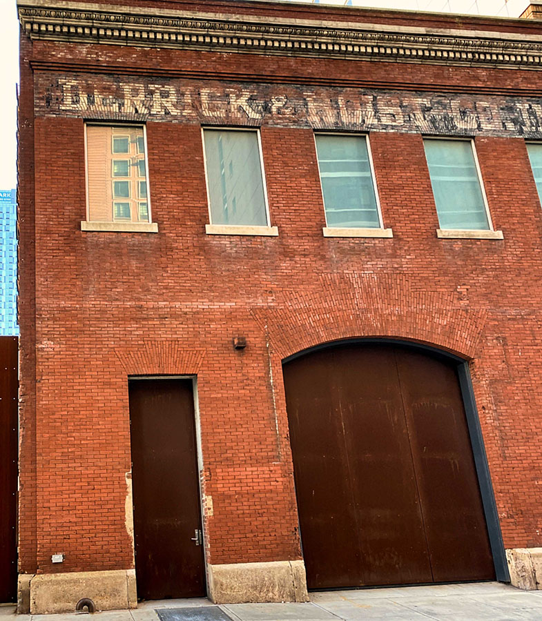
Bike back to Vernon Blvd, turn left (going north) to 44th Rd and turn right to 44th Drive. Turn left on Jackson Ave, then right on Purvis Street. You will find a cool looking industrial dead-end block where frequent elevated trains go by. Here is the ScupltureCenter, located in a former Derricks & Hoists Co, Inc. building (named after equipment, not people). Inside they always have a couple of interesting exhibitions in small rooms and hallways. Outside there’s a sculpture garden.
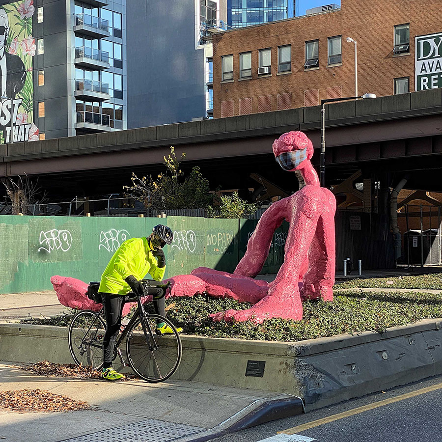
Go back to Jackson Avenue to 43rd Avenue and check out the statue of the Pink Sunbather, whom Martin is posing with.
Roosevelt Island
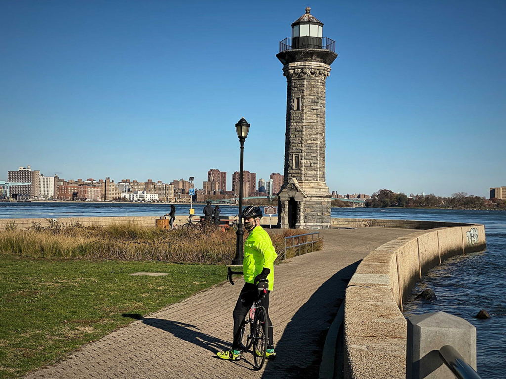
Return to Vernon Avenue, turn right, go to 36th Avenue and turn left to Roosevelt Island. The island is technically not in Queens and administratively in Manhattan, but this is the only bike entry point without taking the subway or tram. It mainly contains a number of residential buildings. On one end is a lighthouse built in 1872.
On the other end, just past a number of fallen Gothic Revival buildings which used to be a smallpox hospital, there’s Franklin Delano Roosevelt Four Freedoms Park (of speech, of worship, from want, and from fear). In his State of the Union Address in 1941, he cited these freedoms as part of the basis to continue aid to Great Britain and boost war production.
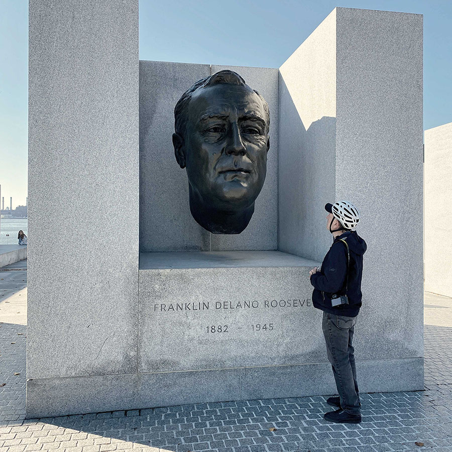
The ride is worth it just for the astounding views of Manhattan.
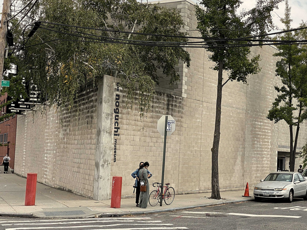
Noguchi Museum
Return to Vernon Avenue, turn left as you immediately enter Astoria. Right past Rainey Park, there’s the Isamu Noguchi Museum. It has 13 galleries and an outdoor sculpture garden of the artwork of the Japanese American sculptor who lived to age 84 and died in 1988.
Socrates Sculpture Park
Bike north a few minutes more and you arrive at Socrates Sculpture Park on the left. It was an abandoned landfill until 1986 when sculptor Mark di Suvero and others transformed it into an open exhibition space. This park is not to be missed and has revolving displays. Pictured below is Jeffrey Gibson’s ziggurat, made of plywood and vibrantly painted with symbols and geometric designs inspired by the pre-Columbian Serpent Mound located in Ohio.
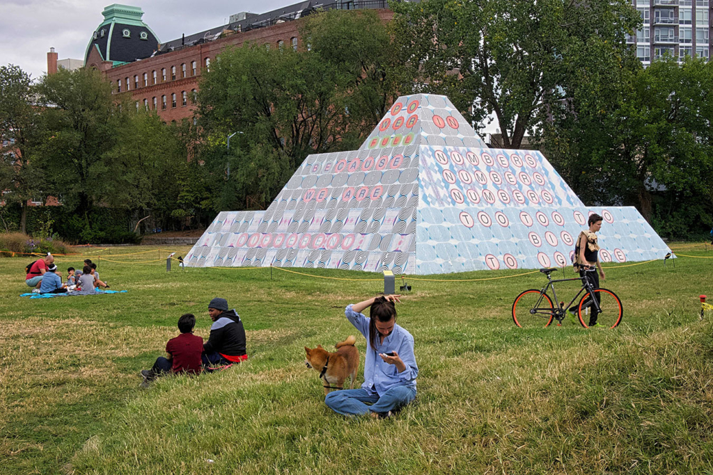
Its name is “Because Once You Enter My House It Becomes Our House”.
Astoria Park
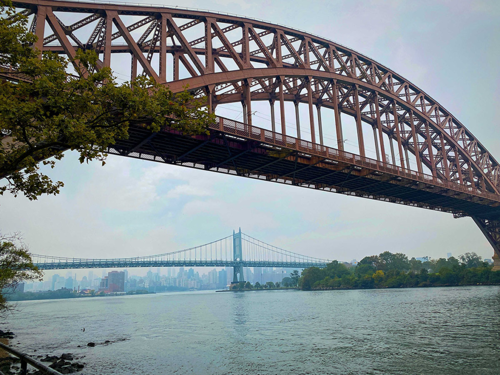
Continuing north on Vernon Blvd and other streets, you arrive at the scenic Astoria Park. It has several areas to picnic and play and many recreation facilities. It has a superb view of the Robert F. Kennedy (Triborough) Bridge and the Hells Gate Bridge. The former is an auto and pedestrian bridge to Randall’s Island (also used by bicyclists even though technically illegal). The latter is a steel-arch railroad bridge over the Hells Gate Channel for passenger and freight trains. Its construction and look are similar to the Sydney Harbour Bridge and Tyne Bridge in Newcastle, UK.
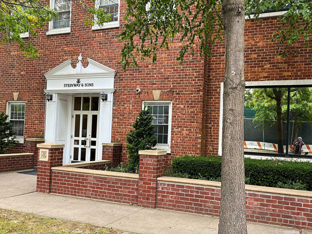
Steinway & Sons Factory
From Astoria Park, ride north on the shore until 20th Avenue. Turn right and continue by a massive Con Ed facility until 37th Street where you turn left. Here’s the Steinway & Son’s Factory where world-class pianos are manufactured. Heinrich Steinweg (later changed to Steinway) immigrated to the United States in 1850 and established the factory in Manhattan, then moved to Astoria in the 1870s. During non-Covid times, tours are available.
Steinway & Sons Mansion
Next to the Steinway & Sons Factory, on 41st Street, is the Steinway Mansion
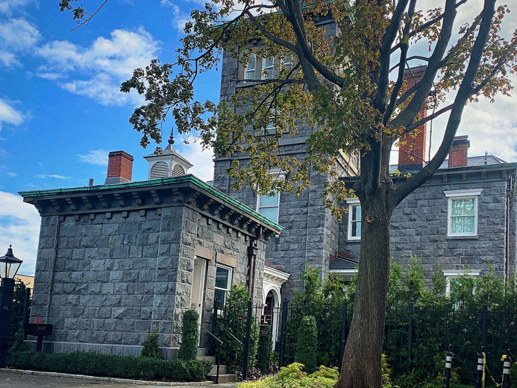
The Steinway Mansion a large Italianate Villa built in 1858 by Benjamin Pike Jr, a successful manufacturer of scientific instruments. In 1874, it was sold to William Steinway and the Steinway family owned it until 1926.
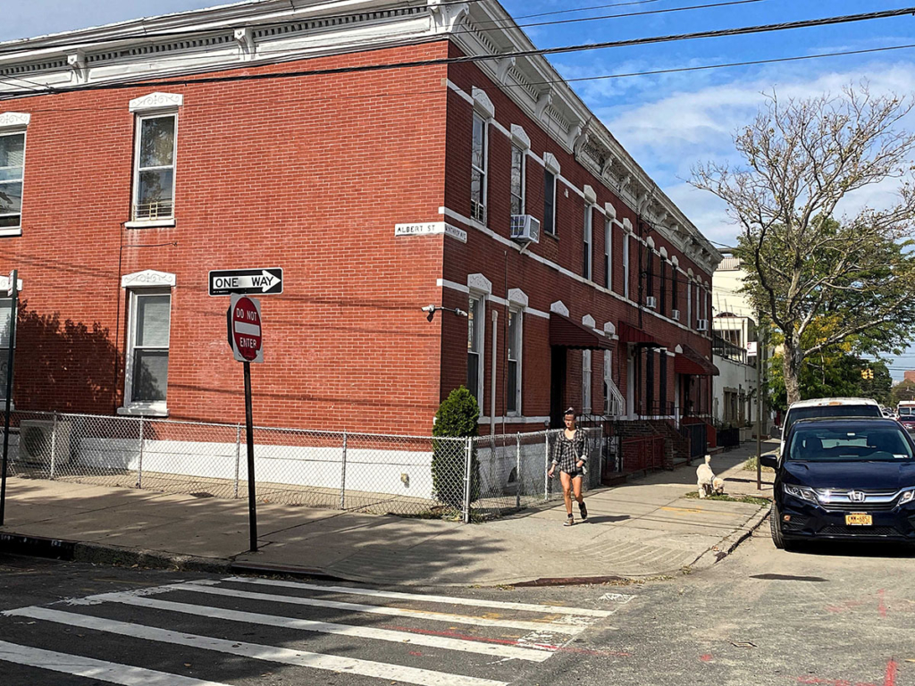
Steinway Row Houses
By this time, it must be apparent that Steinway & Son’s had a massive impact on the development of Astoria. They created a village for its workers which included 29 two-story, red brick row houses around 41st Street and 20th Avenue. Amazingly this didn’t become an NYC Historic District because the residents were successful in stopping it, fearing it would dramatically increase the maintenance cost.
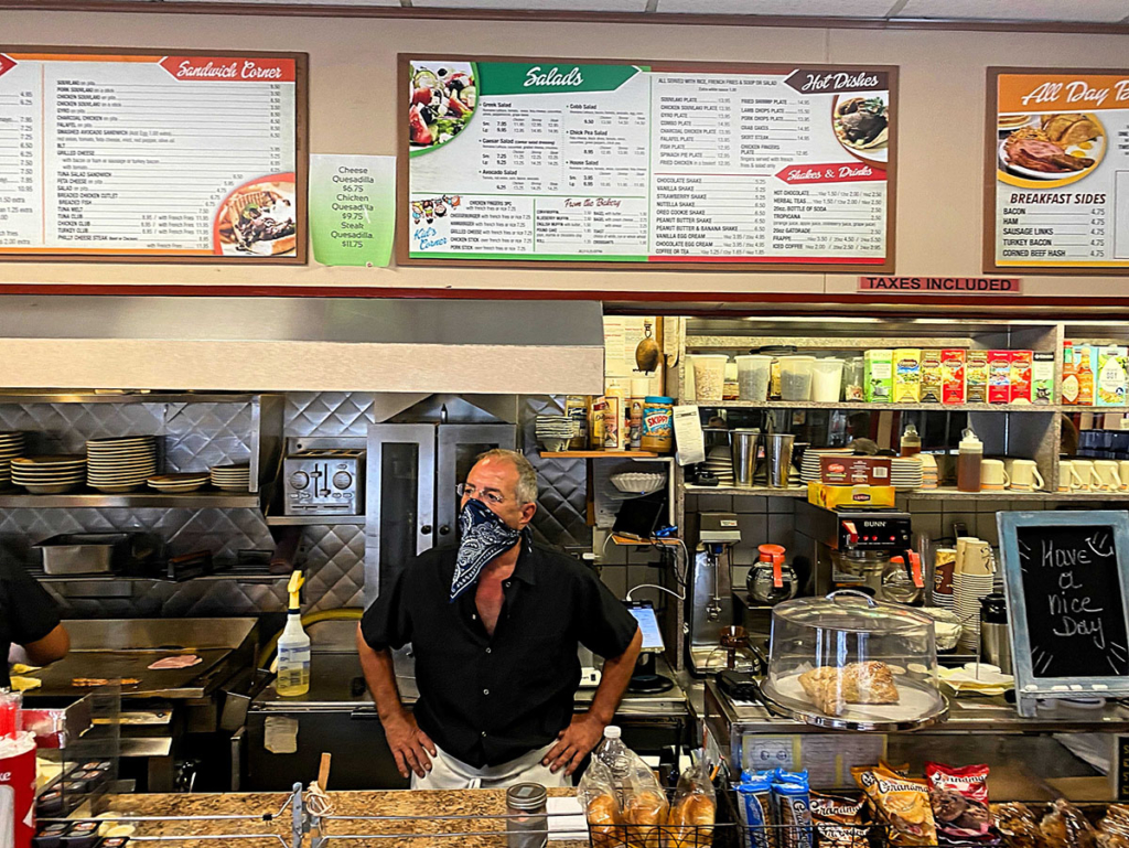
Family Corner Restaurant
You may be hungry for breakfast or lunch by this point. Astoria has many Greek American residents and as a result, many Greek diners. A great one is Family Corner Restaurant at 21st Ave and 31st St. You can sit inside or outside and enjoy the generous portions.
Downtown Astoria
The main shopping area in Astoria is under the elevated N train tracks on 31st St. When Nick and I passed by, there was a rally for racial justice.
Kaufman Astoria Studios
Take a left on any Avenue and go to 36th St. Continue south until you run into Kaufman Astoria Studios, mostly between 34th and 35th Avenues. Built in 1920, it’s one of the biggest movie-production facilities on the East Coast. Two of its notable productions are Orange is the New Black on Netflix and The Bourne Legacy movie.
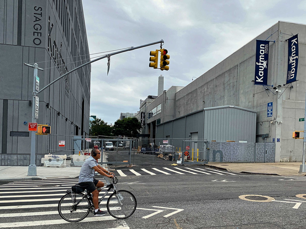
There’s no public access, but you can visit the nearby Museum of the Moving Image.
This is the end of the first itinerary. If you are returning to Manhattan, it’s about a 15-minute, 2 ½ mile trip to the 59th St Bridge. Or you can bike on 35th Ave to Vernon Blvd and then to 30th Road for the Water Ferry. If you are really beat, you can take the subway.
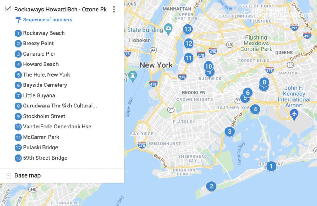
Rockaways, Howard Beach & Ozone Park Biking Itinerary
There are parts of Queens that aren’t a short and easy subway ride from Manhattan and many New Yorkers are unfamiliar with. This is the focus of this itinerary. Some of it has long ocean beaches and protected wetlands, more associated with Long Island than NYC. The itinerary starts in the Rockaway Peninsula, which is over 18 miles from the 59th St Bridge. I recommend taking the A – Far Rockaway train (not Ozone Park) to the starting point. This itinerary is about 20 miles and an hour and half without stopping to the Ozone Park – Richmond Hills area. This is a convenient point to call it a day and take the subway back. If you still have the juice to continue, ride seven miles and 40 minutes without stopping to the Vander Ende–Onderdonk House on the border of Ridgewood, Queens and Bushwick, Brooklyn. Again you have the option of taking the subway or biking an additional seven miles and 40 minutes to the 59th St Bridge and see more interesting sites on the way.
Perhaps to the disappointment of purists, parts of this route go through Brooklyn.
Rockaway Peninsula (The Rockaways)
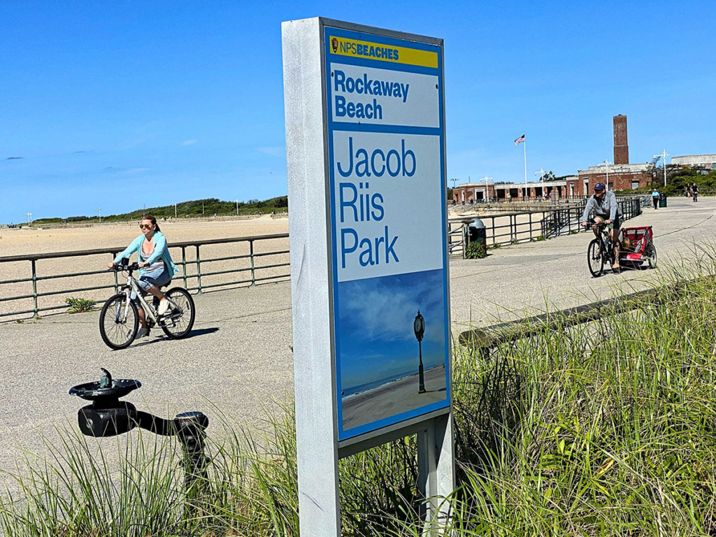
Take the A train (Far Rockaway), which passes JFK Airport and the eye-catching Broad Channel to the Beach 90 Street Holland Station. Go a few blocks to the boardwalk and bike southwest towards Breezy Point. Along the way, notice the wide, white sand beach that people of all economic levels enjoy. In decent weather, there are surfers, swimmers, Frisbee-throwers, sun-tanners and family picnics.
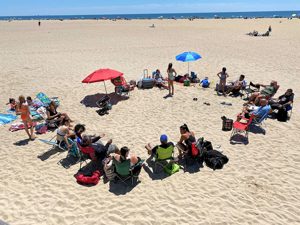
Most of this stretch is part of Jacob Riis Park, named after the muckraking journalist and social documentary photographer of the early 20th century.
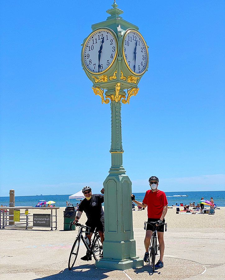
The bike path continues to the landmark Wise Clock. It was built in 1891 and located in various spots in Brooklyn until it was moved here in 1941. It has gone through a number of renovations, as the ocean weather is tough on the exterior and the internal mechanisms.
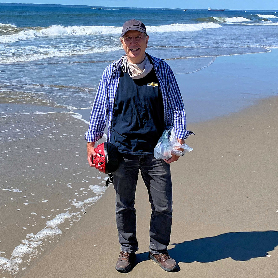
At Fort Tilden, a former military site that’s part of Gateway National Recreation Area, the boardwalk stops and the route follows Rockaway Point Blvd beginning at the Marine Parkway Bridge. Biking to the end, passing the gated community of Roxbury, the path ends at the private Breezy Point Surf Club. Just before there is a sandy path to the tip. Unless you have a mountain bike, you will probably have to walk your bike. Here’s a great expanse of open air and water.
Marine Bridge, Flatbush Avenue & the Belt Parkway
This 10-mile part of the route is mostly in Brooklyn and travels around Jamaica Bay with accompanying wonderful water views.
After crossing the Marine Parkway Bridge, you are on Flatbush Avenue, next to Floyd Bennett Airfield. This place has a number of events, depending on the day, and is on the Bicycling in Brooklyn itinerary.
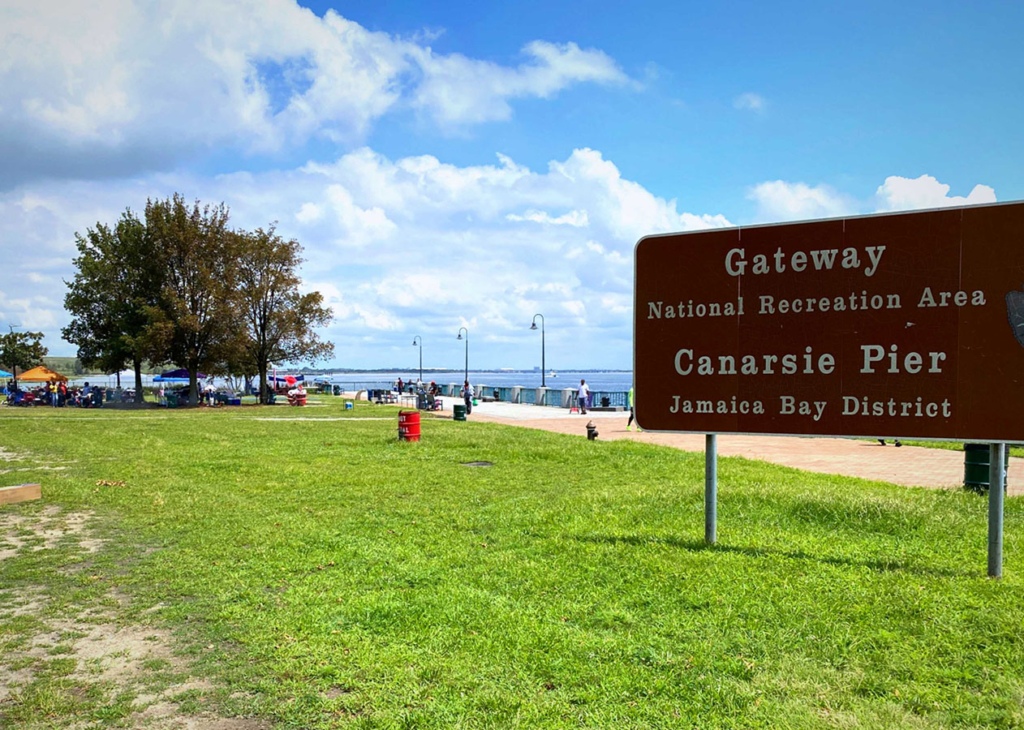
On Flatbush, take a right on the bike path next to the busy Belt Parkway. There are periodic rest stops and picnic places, such as Canarsie Piers which has spots to fish, a playground and a kayak launch.
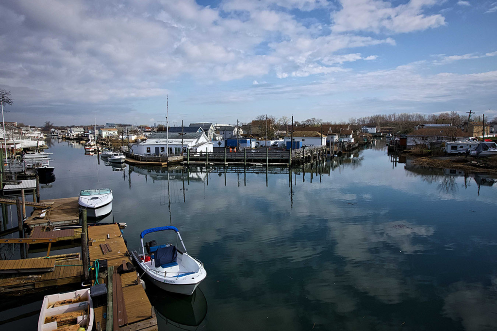
Howard Beach
Bike off the Belt Parkway bike path to 157th Ave and you are in Howard Beach, a tidy neighborhood with canals full of docked boats behind houses. Turn right on 99th St and pedal to the Old Howard Beach and Hamilton Beach enclaves to see a number of picturesque canals.
The Hole
From Howard Beach, cross the Belt Parkway (also called Shore Parkway here), take a left on 156th Ave, right on 79th Street, left on Linden Blvd and right on Emerald Street. Here you arrive at the very strange area of NYC which straddles the Brooklyn and Queens border. The Hole is so named because its 30 feet / 9 meters lower than the surrounding area. This industrial area with a few residences has inadequate sewer systems and usually has streets covered in water. Here we met Margarito, a gentleman originally from Honduras who works as a welder here.
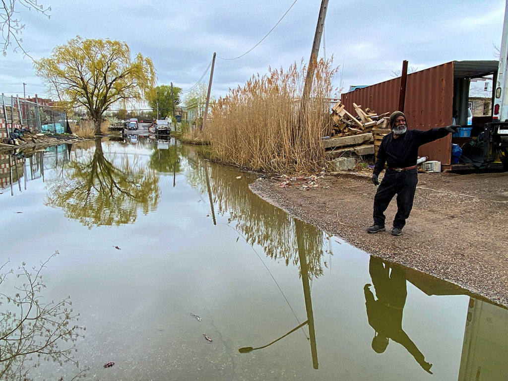
He told us about his family history which originates from many parts of the Caribbean.
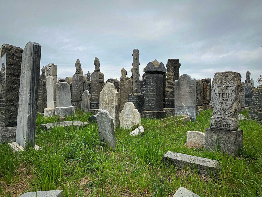
Ozone Park Jewish Cemeteries
Take Forbell Street, turn right on Sutter Ave and left on 84th St. Here are three attached Jewish cemeteries: Bayside, Acacia and Mokom Shalom. These cemeteries were established in the 1800s and the plots are tightly packed together. Over many years of disrepair and vandalism, the cemeteries look overgrown and neglected.
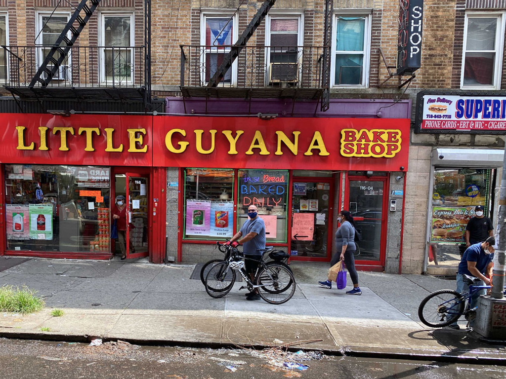
Little Guyana
Turn right on Liberty Ave, under the elevated subway tracks. Continue past a number of auto repair shops until you see continuous retail businesses of Asian-Indian clothing stores, roti shops, take-out Chinese restaurants, fast food joints and Caribbean food markets.
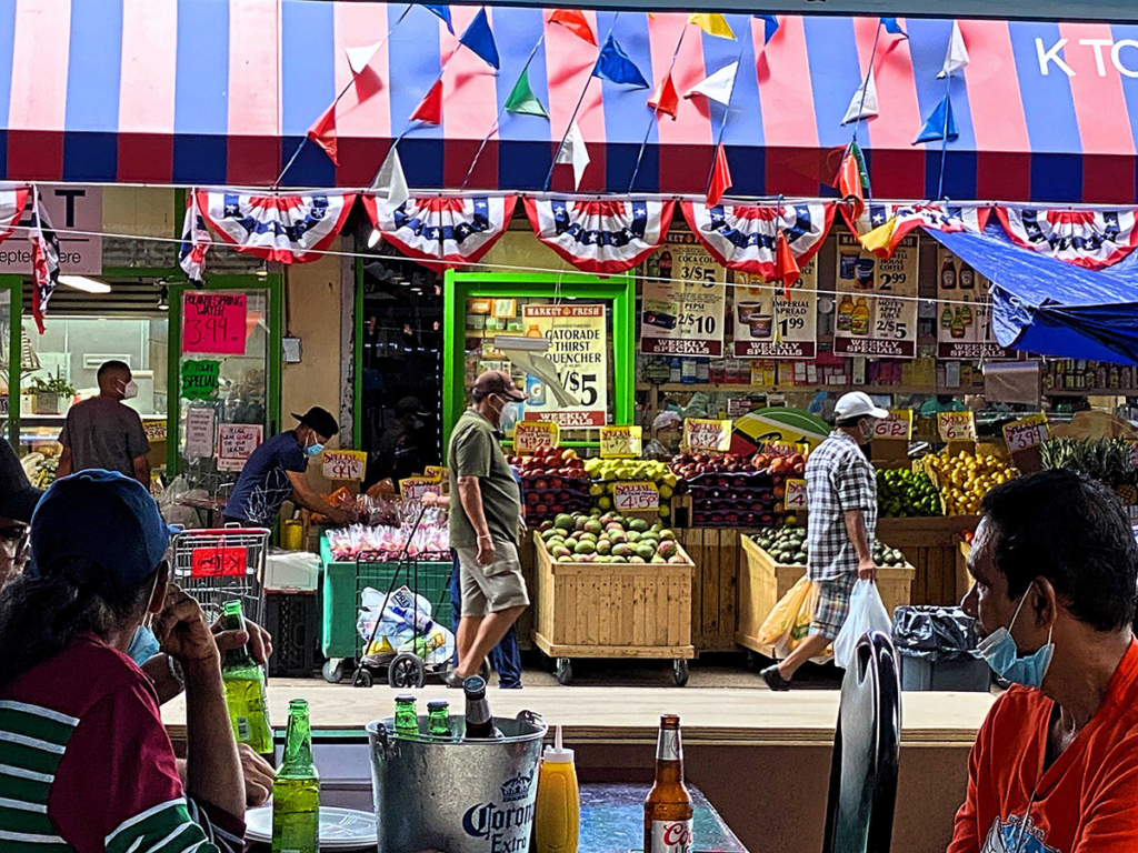
You are very likely to hear Indian music playing loudly from passing cars. This part of Ozone Park is known as Little Guyana (below pictured with Nick), as many residents are from this small South American country.
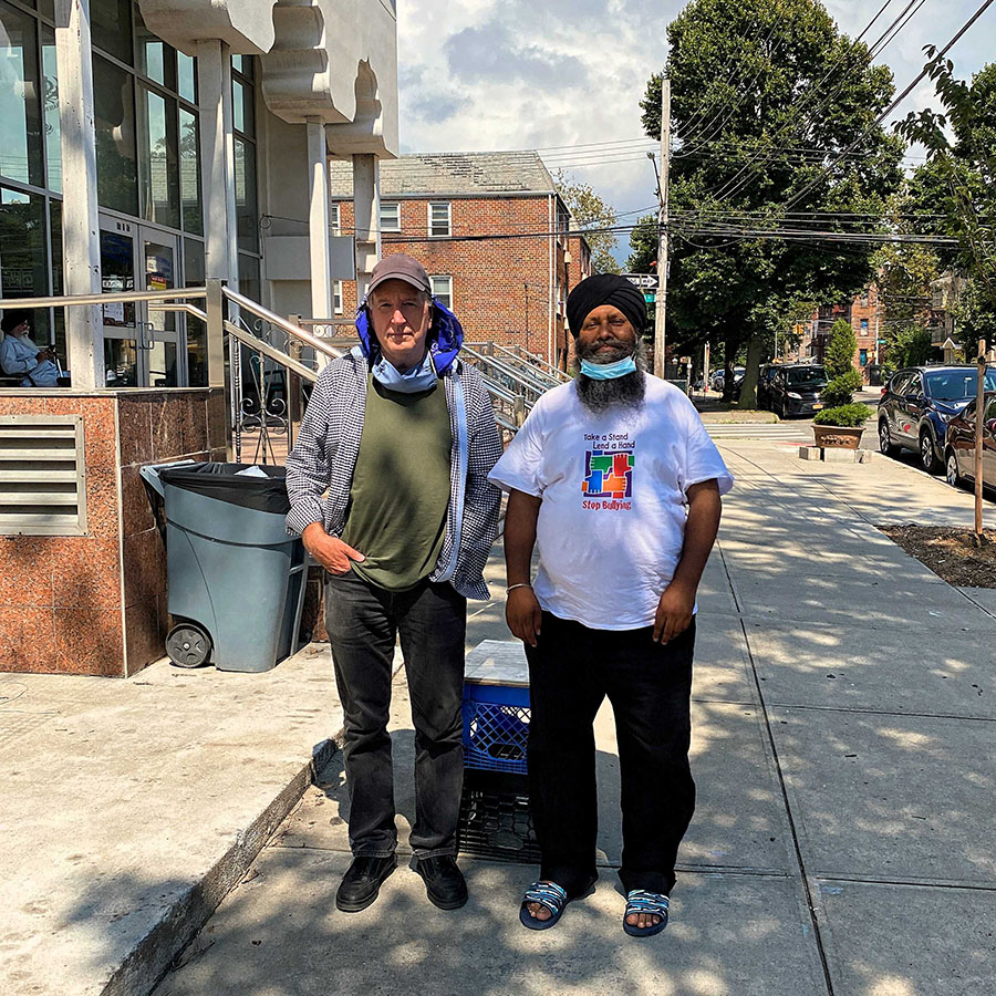
Gurudwara The Sikh Cultural Society
The Ozone Park and Richmond Hills neighborhoods of Queens have quite a few Hindu, Muslim and Sikh temples. One we stopped in was Gurudwara The Sikh Cultural Society on 97th Avenue and 118th Street, where Nick and I spoke to a number of Punjabis sitting outside.
At this point of the itinerary, or anyone following, you may be tired. If so, you can take the subway back to Manhattan or other places in NYC. If you still have energy, let’s continue.
Stockholm Street, Ridgewood
Take any of the streets from Gurudwara and go north to Jamaica Ave, turn left, proceed to Cypress Hills Street, turn right between two cemeteries, left on Myrtle Avenue, right on Wyckoff Avenue, then finally right on Stockholm Street.
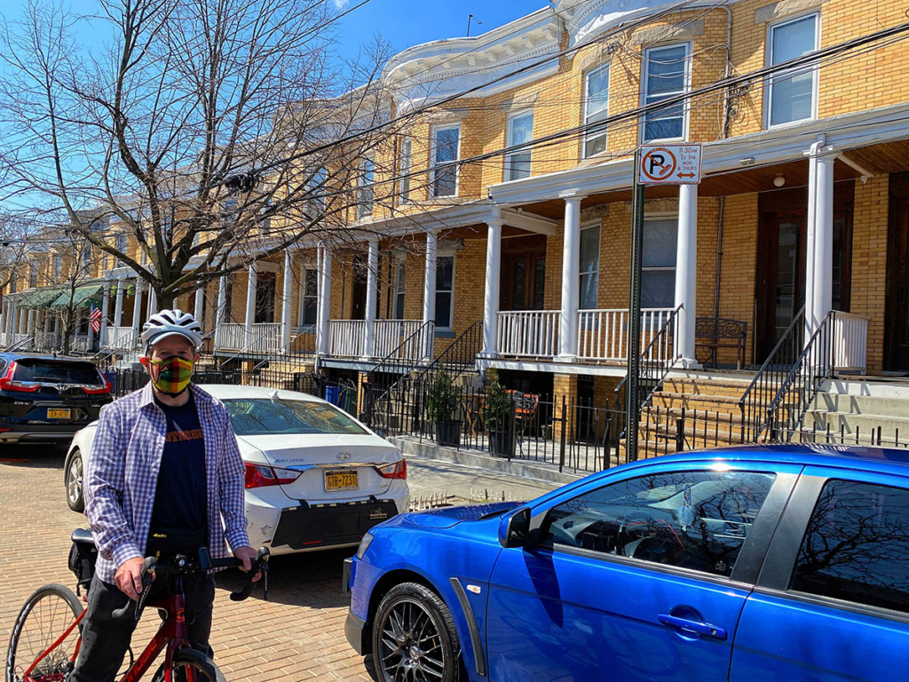
The block is landmarked with 36 homes built with yellow brick from the Balthazar Kreischer kilns of Staten Island and with Doric-columned porches. The street is the only brick-paved street in Queens with red-brown brick from the same kilns. There is no other block like this in Queens or NYC.
Vander-Ende Onderdonk House
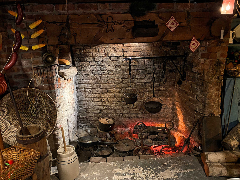
Take St. Nicholas Ave north and turn right on Flushing Ave. In a couple of minutes there’s an anomaly in this industrialized border of Queens and Brooklyn. Sitting on two acres is the oldest Dutch Colonial stone house in New York City, the Vander-Ende Onderdonk House, built in 1709.
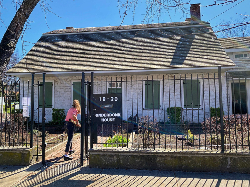
For $5 per person, you get a tour of the place and see how they lived in the 18th Century (see the fireplace for cooking shown below) and in a frame addition in the 19th Century. You learn a ton about how the area has developed over the centuries. The tour usually takes a half-hour, but we spent a full hour because we couldn’t stop asking questions and no one was waiting.
Ride to the 59th Street Bridge
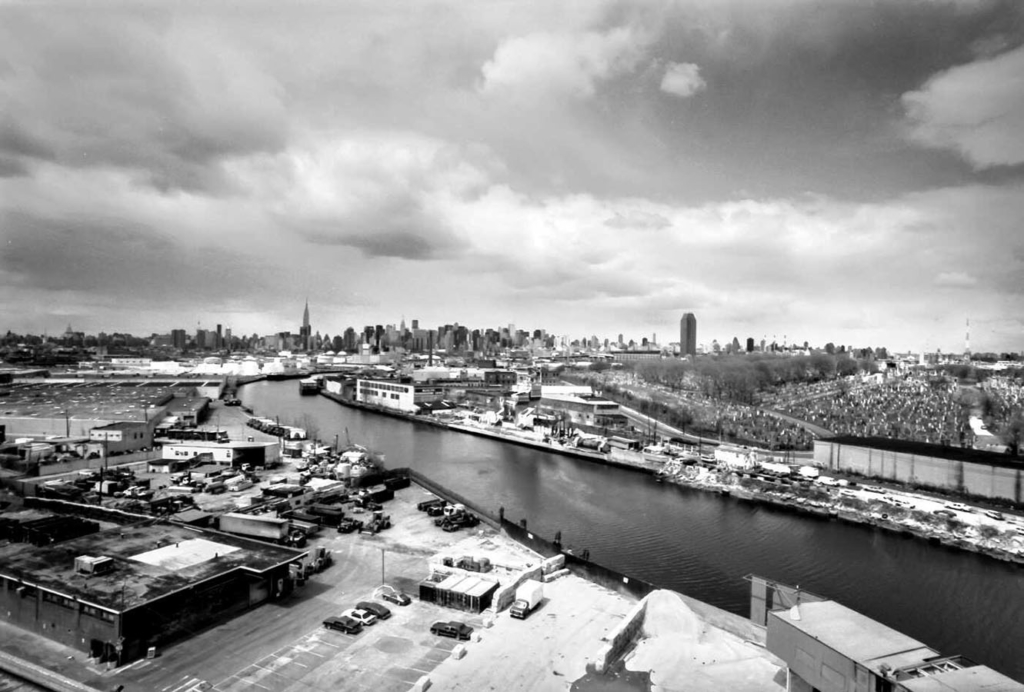
There are many ways to the 59th St Bridge, but the most direct goes through Bushwick (full of outdoor murals), pass McCarren Park in Greenpoint and on the Pulaski Bridge over Newtown Creek, here the border of Brooklyn and Queens. I like this black and white rendition of the creek and Manhattan in the distance.
Once over the bridge, you are in Long Island City, where the first itinerary began and a few minutes from the 59th St Bridge
Other Queens Destinations
There are many other destinations for a bike trip. Here are three to consider.
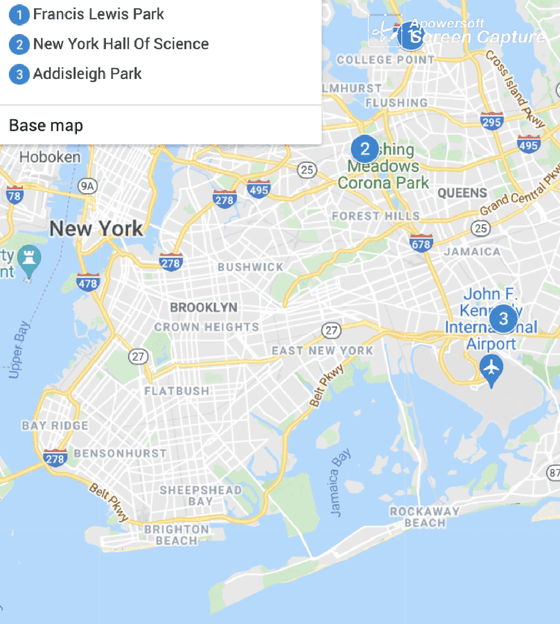
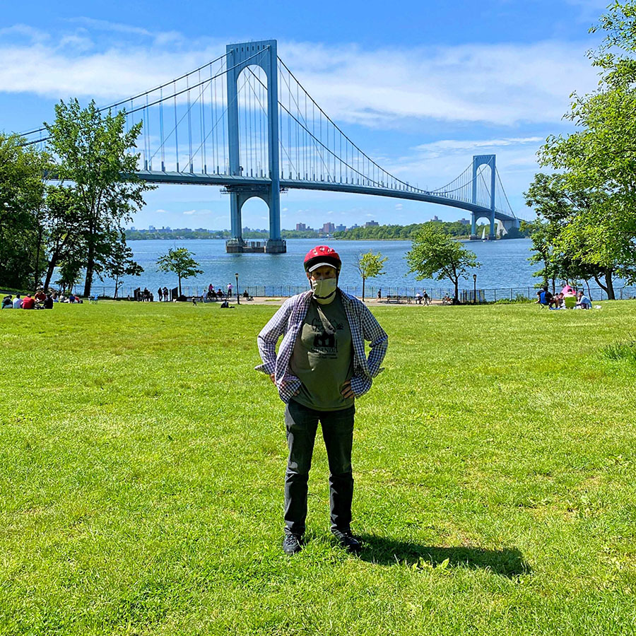
Francis Lewis Park
This is a medium-size park next to the Whitestone Bridge. The views of the Bridge and the East River are wonderful.
On one side of the Bridge is the Melba neighborhood, which has a number of very large, elaborately decorated single-family houses. On the other side is the Whitestone neighborhood, which is an old enclave in Queens, far from the subway. The area was part of the estate of Francis Lewis, a delegate to the Continental Congress and a signer of the Declaration of Independence. Nearby is on-the-water Fort Totten Park with a preserved Civil War fortress, other historic buildings, and a training site for the NYC Fire Department.
New York Hall of Science
Flushing Meadows Corona Park is most known for two twentieth century World’s Fairs and The Unisphere, a huge, stainless steel globe that everyone sees on most highways going to the NYC airports. It also has the New York Hall of Science, an excellent interactive museum for children. While there, I was impressed with the lectures.
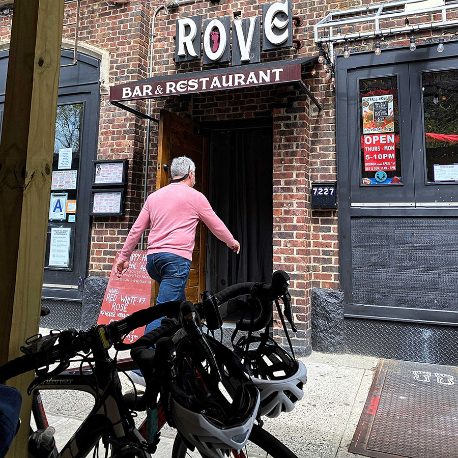
If you are hungry, go either to Austin Street in Forest Hills which has a great variety of restaurants, including Rove where Nick and I ate after many hours of biking and enjoyed the friendly service and imaginative pub food.
Also nearby is downtown Flushing with a panoply of Asian restaurants.
Addisleigh Park
In the St. Albans neighborhood, Addisleigh Park is a historic section with English Tudor and neo-Colonial Revival houses. It’s a traditionally African American neighborhood and was home to some exceptionally famous and talented figures including Ella Fitzgerald, Jackie Robinson, James Brown, Lena Horne and Count Basie.
Final Thoughts
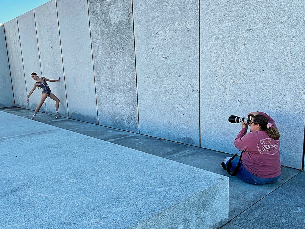
There’s a ton of things to see in Queens and NYC, but many of my best experiences have been stumbling upon something unexpected. For instance, when biking on Roosevelt Island, we saw a group of ballet dancers in relatively cold weather. It didn’t seem like a normal situation to practice. Then we were informed it was a photo shoot for ballet clothing.
So bike through Queens and see the amazing ethnic diversity, but also be prepared for and embrace the unanticipated, often involving friendly encounters with locals.